





Reference: CALE-ROUE-3D
Brand: AEROWOOD
Pair of wheel chocks for light aircraft and microlights, 3D printed with your registration inlaid in a second colour: smooth surface, nothing sticks out or wears off.UV, water and fuel resistant plastic. Choice of chock and lettering colours.
Reference: PLAQUE-CONSTRUCTEUR
Aviation-style manufacturer plate in black anodised aluminium, silver engraving. Ready-to-fill template: manufacturer, model, serial number, year, registration. Sizes 100 × 50 and 120 × 60 mm.
Reference: PLAQUE-ALU
Black anodised aluminium plate with high-contrast silver laser engraving. Sizes 70 × 30, 100 × 50, 150 × 50 mm. Light and UV-resistant.
Reference: PLAQUE-INOX
304L brushed stainless steel plate, laser-engraved (dark brown engraving). Sizes 100 × 50, 80 × 40, 60 × 30 mm. Made in our workshop.
Reference: 010-02804-81
Brand: GARMIN
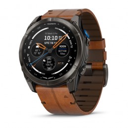
51 mm aviator watch with AMOLED display and sapphire lens (previous generation, while Garmin stocks last): maps, navigation, weather, flight logging.
Reference: 010-03199-51
Brand: GARMIN
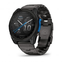
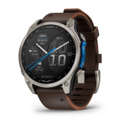
The D2 Mach 2 with LTE and satellite connectivity: messaging and position tracking even without a phone, on top of full aviation features.
Reference: 010-02905-31
Brand: GARMIN
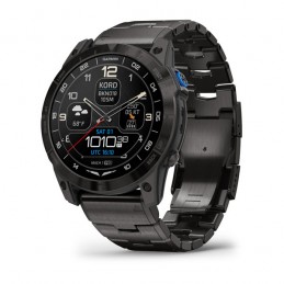
Premium 51 mm aviator watch with AMOLED display and sapphire lens, titanium case and band: aeronautical maps, navigation, weather, flight logging, LED flashlight.
Reference: 010-02904-31
Brand: GARMIN
Premium 47 mm aviator watch with AMOLED display and sapphire lens: aeronautical maps, navigation, weather, flight logging, LED flashlight, multi-week battery life.
Fly with confidence with a rugged, reliable, purpose-built GPS featuring the latest in-flight capabilities, including IFR approaches, arrivals and departures, plus a 7-inch (17cm) touchscreen interface.

Fly with confidence with our rugged, reliable, purpose-built GPS featuring our latest in-flight capabilities, including IFR approaches, arrivals and departures, plus our familiar touchscreen interface.

Bright days are no problem thanks to our vivid, sunlight-readable touchscreen.

Make IFR flying easier by adding airways as well as IFR approaches, arrivals, departures and more to your route.

Stay aware down low. Identify obstacles and wires with our WireAware™ wire-strike avoidance technology.

Weather and traffic? Check and check. Simply pair it with a GTX™ 345 transponder or a GDL® 52 series datalink.

Prepare your flight with wireless internet weather and automatic data downloads.

Take off with round-trip power. Get up to 4 hours of battery life on every charge.
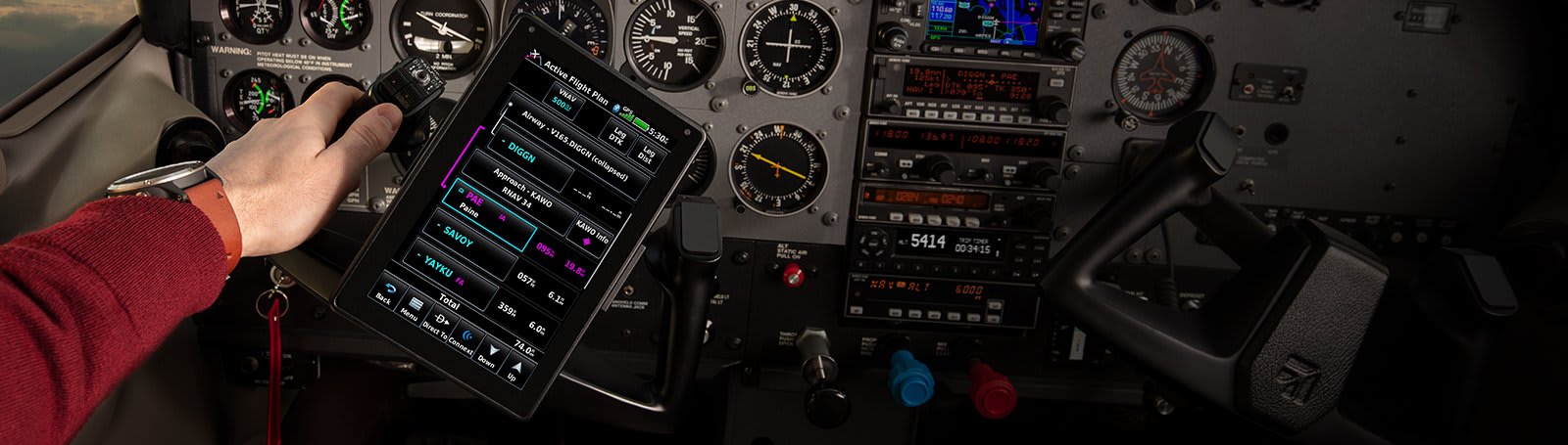
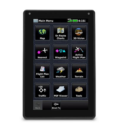
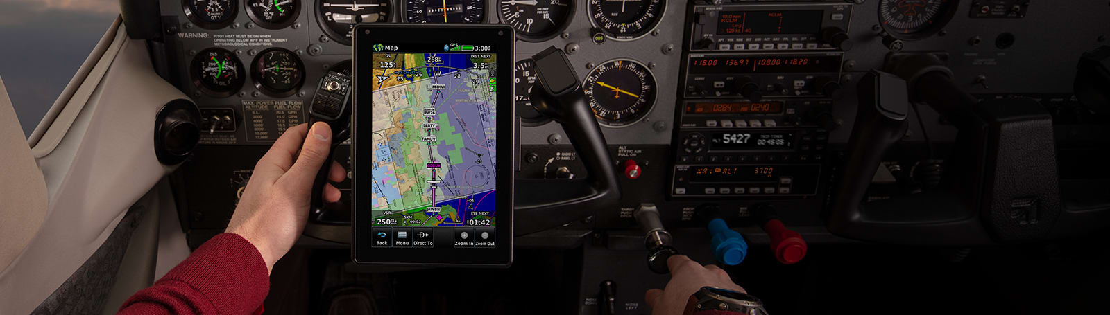
The large 7-inch, sunlight-readable touchscreen is twice as bright as many tablets, with portrait and landscape display options and intuitive pinch-to-zoom and panning.
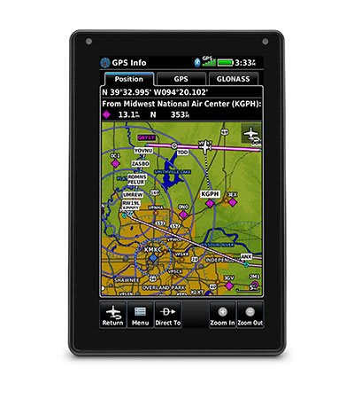
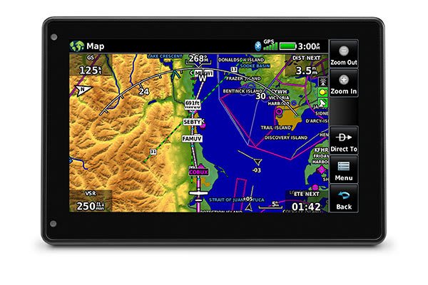
Quickly and reliably acquire GPS and GLONASS satellite constellations to display rich, interactive, dynamically drawn and customizable aviation maps.
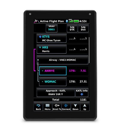
Creating flight plans is simple. Enter a departure waypoint and a destination, then insert segments, including airways as well as IFR departures, arrivals and approaches.

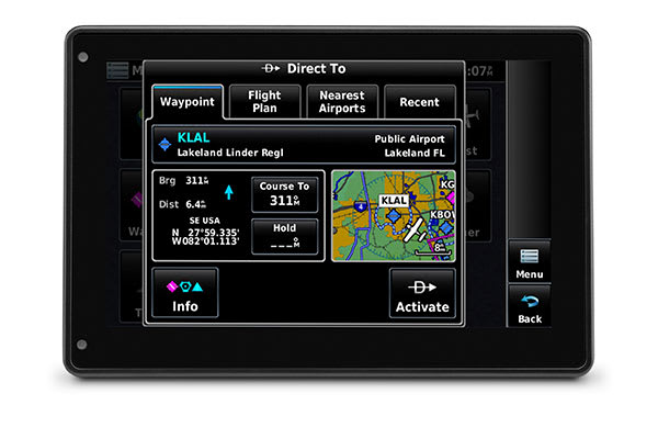
An on-screen Direct-to key lets you quickly enter a direct course to any selected waypoint. A menu of the nearest airports and flight plan waypoints makes entry easy.
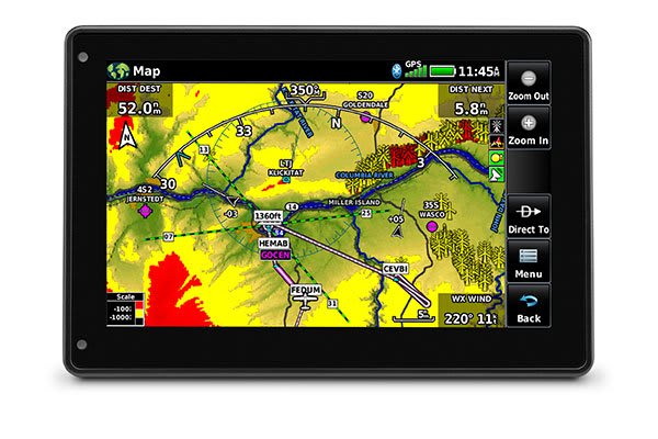
View ground references – including airports, cities, terrain, obstacles and more – on the dynamic map display to easily determine your position on VFR flights.
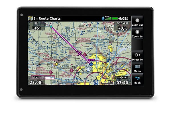
View georeferenced VFR sectional charts for the United States, Canada and Europe.
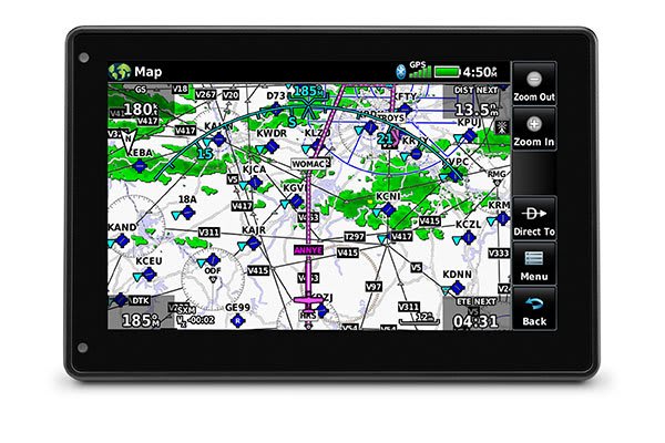
Use IFR map mode to view and navigate high or low en route airways. Tap to display minimum en route altitudes and distances between intersections.

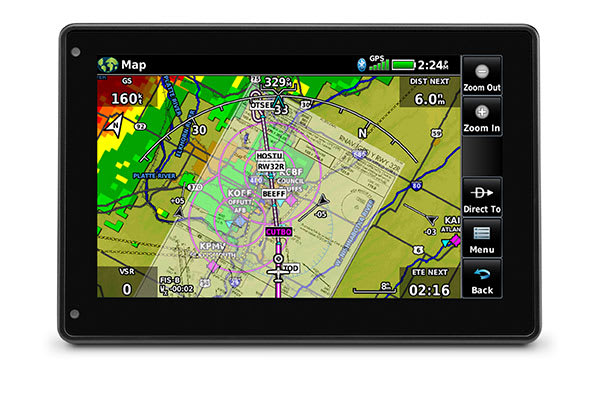
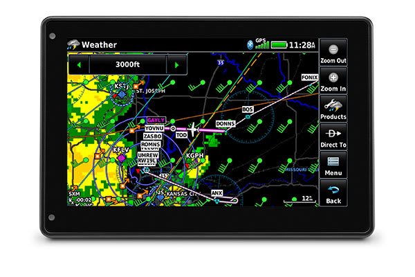
With available Garmin ADS-B “In” equipment solutions, the aera 760 displays ADS-B traffic targets as well as subscription-free U.S. weather data, either wirelessly or with an optional power/data cable.

Patented TargetTrend relative motion tracking on the aera 760 gives pilots a faster, more intuitive way to judge traffic closure rates and trajectories, so you can identify the biggest threat.
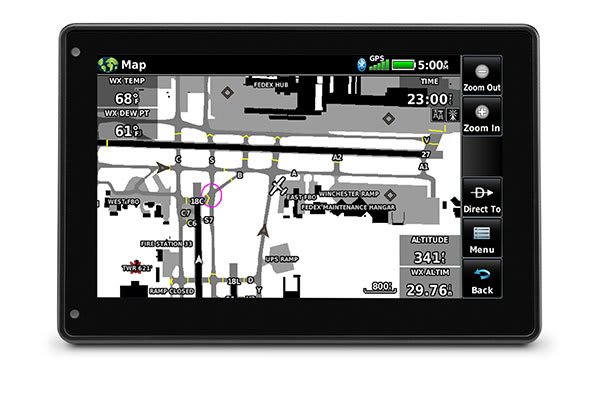
Providing a dynamic display of ADS-B-equipped aircraft and ground vehicles, this technology helps pilots avoid traffic conflicts in the airport environment.
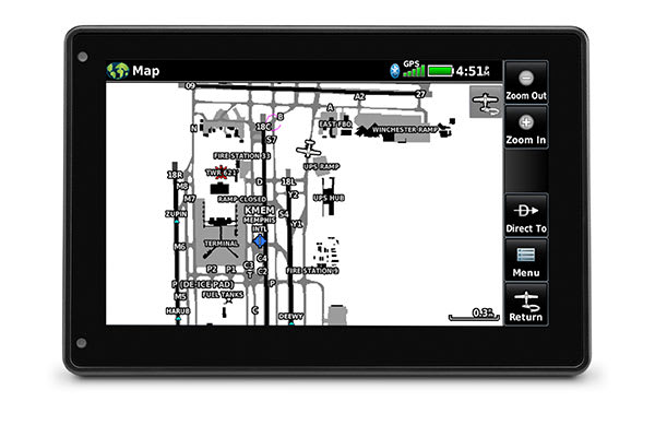
After landing, georeferenced SafeTaxi diagrams on the aera 760 automatically help track your position at hundreds of airports and even identify published hot spots.
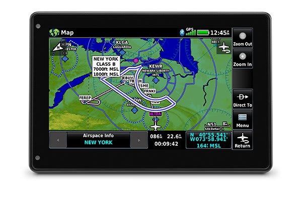
Patented Garmin Smart Airspace guidance highlights the airspace closest to your current altitude so you can quickly identify your position relative to the airspace around you.
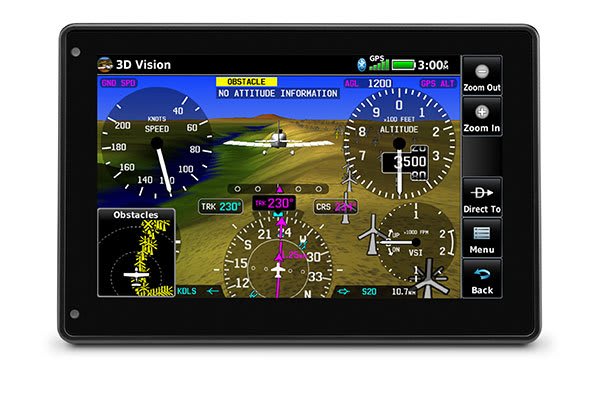
3D Vision technology gives you a virtual 3D perspective view from behind the aircraft of surrounding terrain, obstacles and airports, as well as traffic (when ADS-B “In” equipped).
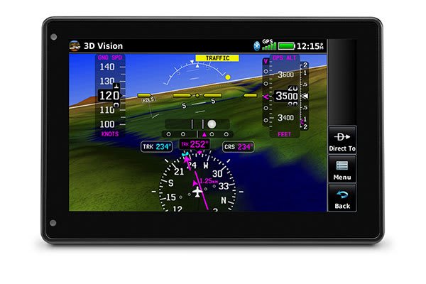
View synthetic vision (SVX™) by panel-mounting your aera 760 and using its built-in AHRS, or by connecting it to another AHRS-equipped device, such as a GDL 52 series datalink.
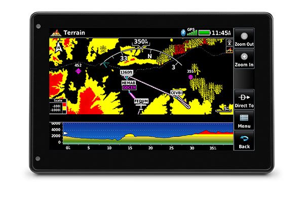
See your position relative to terrain and obstacles on the map and in profile view. Obstacles within 1 000 feet (or a pilot-customizable height) are highlighted in yellow, while obstacles within 100 feet are highlighted in red.
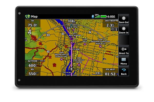
Garmin WireAware wire-strike avoidance technology graphically overlays hazardous obstacle transmission (HOT) lines that cross rivers and canyons directly on the moving map.
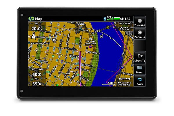
Optional maps give pilots access to street intersections and other non-aviation waypoints for easier navigation.
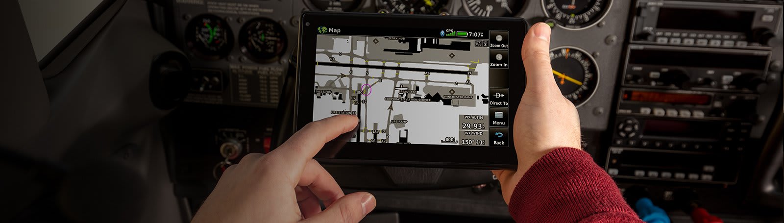
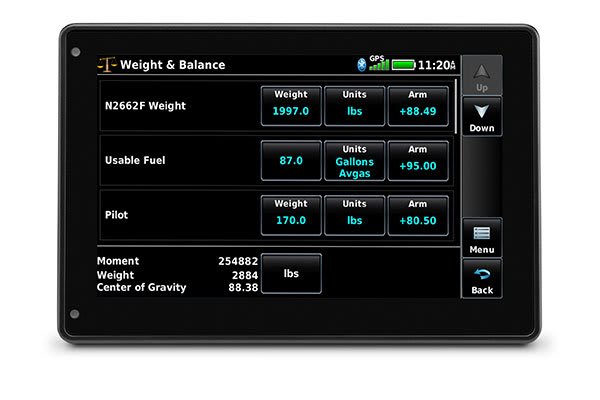
The aera 760 serves as an electronic flight bag, with georeferenced charts, a PDF viewer, an E6B computer, a weight and balance calculator, a logbook and much more.
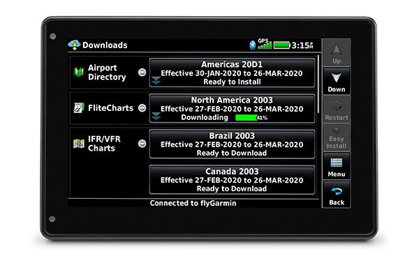
Check internet weather on the ground for preflight planning and update databases at home via Wi-Fi. Plus, stay current all year long with a single annual subscription that includes all the databases you need.
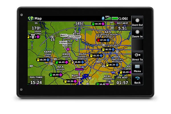
Fuel price data can be overlaid on the map to see prices in an area at a glance – or viewed on the airport directory page.
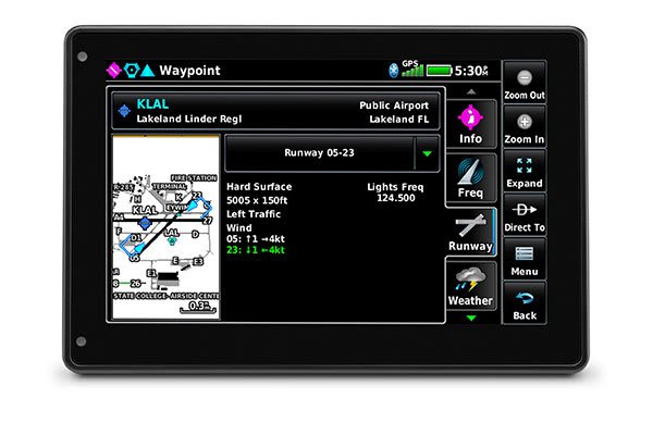
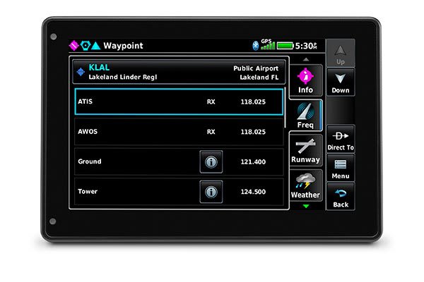
Tap an airport symbol on the map to open its airport information page and view runways, frequencies, NOTAMs, FBOs and more.
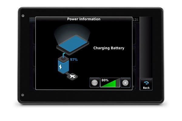
Get up to 4 hours of flight time on each charge, or easily power it in flight with a USB-C ® .
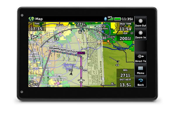
The aera 760 combines many capabilities of panel-mount avionics in a purpose-built, high-value package. It is ready to fly, right out of the box.
| Carrier | Information | Delivery |
|---|---|---|
 | Parcel delivered to the Pickup relay of your choice in 24/48 hours. You will be notified by email and SMS. | |
 | Parcel delivered to your home the next day before 6pm. The day before delivery, you will be notified by e-mail and SMS. |